


Smiley Twp. Voting District, Pennington County, Minnesota
About
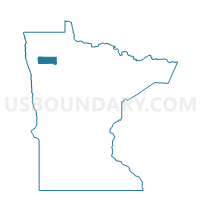
Outline

Summary
| Unique Area Identifier | 603564 |
| Name | Smiley Twp. Voting District |
| County | Pennington County |
| State | Minnesota |
| Area (square miles) | 36.19 |
| Land Area (square miles) | 36.00 |
| Water Area (square miles) | 0.19 |
| % of Land Area | 99.47 |
| % of Water Area | 0.53 |
| Latitude of the Internal Point | 48.06330870 |
| Longtitude of the Internal Point | -96.04690510 |
Maps


Graphs
Select a template below for downloading or customizing gragh for Smiley Twp. Voting District, Pennington County, Minnesota


Neighbors
Neighoring Voting District (by Name) Neighboring Voting District on the Map
- Clover Leaf Twp. Voting District, Pennington County, MN
- Kratka Twp. Voting District, Pennington County, MN
- North Twp. Voting District, Pennington County, MN
- River Falls Twp. Voting District, Pennington County, MN
- Rocksbury Twp. East Voting District, Pennington County, MN
- Silverton Twp. Voting District, Pennington County, MN
- Wyandotte Twp. Voting District, Pennington County, MN
Top 10 Neighboring County Subdivision (by Population) Neighboring County Subdivision on the Map
- Rocksbury township, Pennington County, MN (1,211)
- North township, Pennington County, MN (708)
- Smiley township, Pennington County, MN (580)
- Silverton township, Pennington County, MN (187)
- River Falls township, Pennington County, MN (178)
- Kratka township, Pennington County, MN (131)
- Wyandotte township, Pennington County, MN (130)
- Cloverleaf township, Pennington County, MN (84)
Top 10 Neighboring Unified School District (by Population) Neighboring Unified School District on the Map
Top 10 Neighboring State Legislative District Lower Chamber (by Population) Neighboring State Legislative District Lower Chamber on the Map
Top 10 Neighboring State Legislative District Upper Chamber (by Population) Neighboring State Legislative District Upper Chamber on the Map
Top 10 Neighboring 111th Congressional District (by Population) Neighboring 111th Congressional District on the Map
Top 10 Neighboring Census Tract (by Population) Neighboring Census Tract on the Map
- Census Tract 905, Pennington County, MN (3,831)
- Census Tract 901, Pennington County, MN (2,382)
- Census Tract 903, Pennington County, MN (2,079)